
Furuno GP-39 GPS Navigator
Quantity:
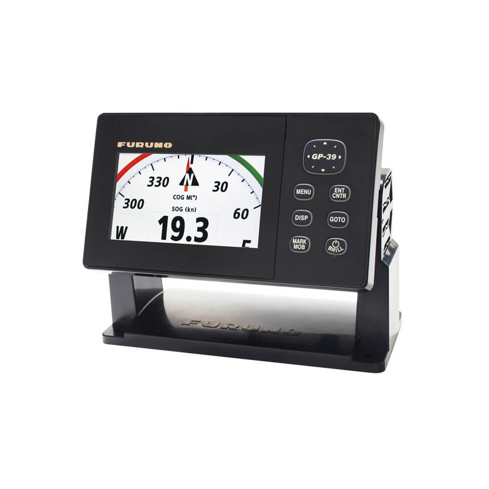
Furuno GP-39 GPS Navigator
The Furuno GP-39 GPS Navigator delivers the position information to an interfaced fish finder or sonar. Also, the GP-39 receives the TLL (Target Latitude/Longitude) sentence from networked fish finders or sonars and can display the received information. This allows you to mark fish school locations easily. Waypoint, route data and setting information can be exported/imported via a USB ash drive between GP-39 units. The waypoint and route data in GP-32 can be transferred to GP-39 by means of signal converter. You can backup information, or share useful information between vessels. The improved hanger allows the display unit to be mounted or un-mounted easily. The display unit can be carried in the bag (standard supply).Features:
- GPS core delivers enhanced position fixing accuracy.
- 4.2" high-resolution colour LCD.
- Storage for 3,000 track points, 10,000 waypoints and 100 routes.
- SBAS capable for better positioning calculations.
- Share and display position information on networked equipment such as a fish finder, sonar, radar, etc.
- Waypoint and route data can be exported/imported via a USB flash drive or signal converter.
- Multi-language ready : English, French, Spanish, Chinese, Vietnamese, Malay, Indonesian and Thai.
- Easy to mount on/off the bracket.
- The improved hanger allows the display unit to be mounted or un-mounted easily. The display unit can be carried in the bag (standard supply).
Specifications
Display Unit
- Screen Type: 4.2" Color LCD
- Screen Resolution: 480 (V) x 272 (H) pixels
- GPS Antenna: External
- Display Modes: Plotter, Highway, Steering, NAV Data, Satellite monitor, User Display (Digital, Speedometer, COG)
- Language: English, French, Spanish, Chinese, Vietnamese, Malay, Indonesian, Thai
GPS / SBAS (WAAS/EGNOS/MSAS)
- Receiving Type: GPS: 12 channels parallel, 12 satellites tracking, C/A code, all-in-view, SBAS: 2 channels
- Receiving Frequency: L1 (1575.42 MHz ± 1.023 MHz)
- Accuracy: GPS: 10 m (95% of the time, HDOP≤4), WAAS: 3 m (95% of the time, HDOP≤4), MSAS: 7 m (95% of the time, HDOP≤4)
PLOTTER
- Memory Capacity: 3,000 ship's track points, 10,000 waypoints with comments, 100 routes with 30 waypoints/route
OTHERS
- Waterproofing: Display unit: IP55, Antenna unit: IP56
- Power Supply: 12-24 VDC : 0.7-0.3 A
- Weight: 0.86 kg (Bracket mount)
